


Connecting Disjointed Parts of Richmond: Manchester to Downtown
Welcome to What’s Next, Richmond (WNR). This week we continue our series focusing on sections of Richmond that are geographically close, but difficult to travel between without the use of a car.

In our last story we discussed the difficulty of traveling between the Northside and Downtown Richmond on foot or by bike, despite the short distance between the two, and disseminated ways in which the City may address the issue. This week we will focus on an area of Richmond that is split by the James River rather than an interstate highway, but note that several design decisions made in the past have created a similarly disjointed situation. Following the stories of daily commuters along this route, we will look at how the City of Richmond already plans to address the disconnected nature of this section of the City as well as discuss short term solutions that could bring relief on a faster time scale.
Connecting Downtown Richmond and Manchester
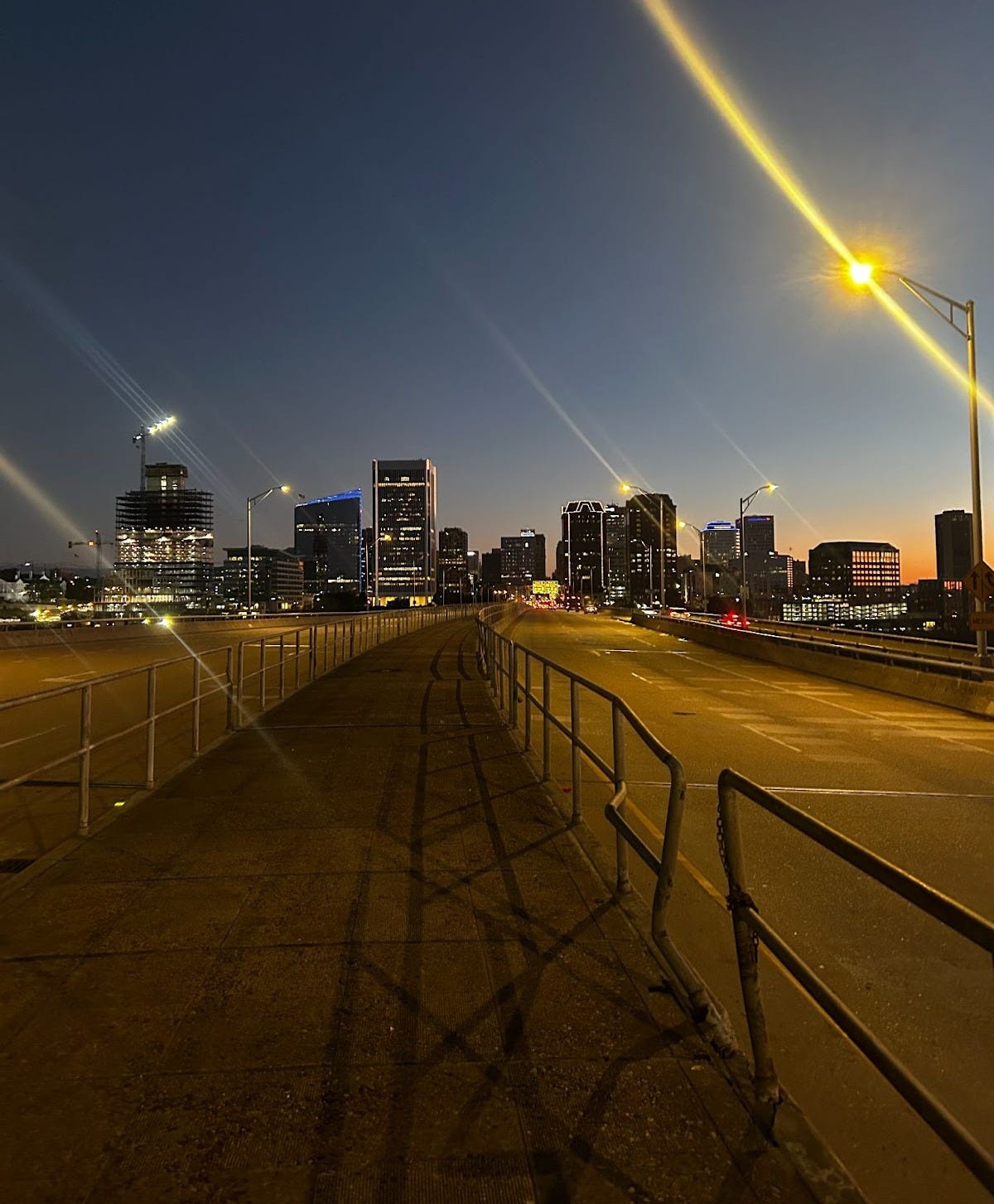
The difficulty of traveling over the Manchester Bridge outside of a car.
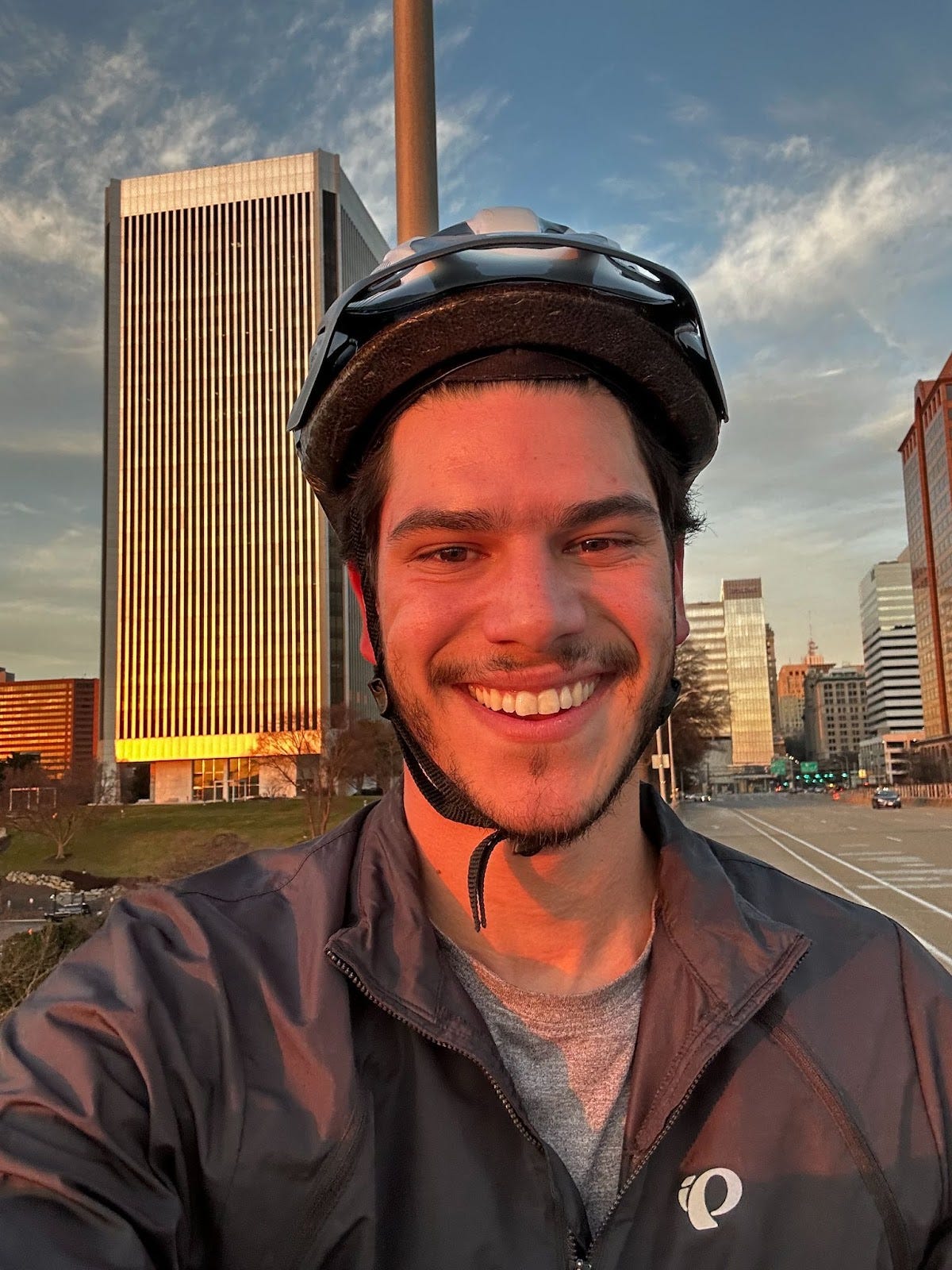
Kyle Mendez is a Richmond Public Schools teacher (and a colleague of mine) who commutes to work by bicycle. From his home South of the James River, he crosses the Manchester Bridge as a part of his daily routine.
Kathy Paschall, another RPS teacher and bike commuter, prefers to trek across the nearby “T.Pot” pedestrian bridge on her way to work. Her primary rationale is one of aesthetics—she loves experiencing the natural beauty of the river and Brown’s Island during her daily trip (There’s some major improvements coming to Brown’s Island, by the way).

Mendez’s preference for the Manchester Bridge is a combination of empathy and efficiency. He doesn’t like dodging pedestrians on the T.Pot bridge while he rides, equating it to the discomfort a bicyclist feels when being overtaken by a fast moving car. He also likes shaving a few minutes off of his overall trip by taking the Manchester Bridge.
Traveling along the more efficient Manchester Bridge by bike, however, is not for the faint of heart.

In order to access the bridge Mendez has to bike in mixed traffic with cars on what looks like a highway entrance ramp.
Mendez mentions that the on-ramp narrows as he approaches the bridge and he has been closely passed multiple times while trying to access the bike lane at the end, adding that he is afraid he could be pushed off the bridge if he were to be side-swiped or rear-ended.
After climbing the ramp, Mendez then enters the buffered bike lane that spans the remaining portion of the bridge. The buffer provides some distance between the passing cars on the bridge and bicyclists, though Mendez mentions that periodically he has to veer closer to the car lane to dodge stormwater grates that are in his lane.

The speed limit on this section of 9th Street has been 35 mph for several years, but drivers frequently cross the bridge at considerably higher speeds. In defense of the car drivers, a highway-style on-ramp followed by straight, wide lanes triggers the muscle memory of driving on an interstate highway. Unlike an interstate highway, however, this stretch of road leads to a stoplight in the middle of Downtown Richmond.
Two blocks into Downtown Richmond, the bike lane ends and suggests that bicyclists merge into mixed traffic.

Mendez’ commute, however, leads him to turn prior to the end of the bike lane onto Byrd Street.
In order for him to turn onto Byrd Street, he has to merge into a 550 foot long deceleration lane for cars. According to a 2014 study published in the journal Safety Science, a 500 foot deceleration lane is ideal for car traffic traveling at 55 mph, and a 600 foot deceleration lane is needed for car traffic traveling at 65 mph. Recall that the posted speed limit is 35 mph.

Mendez describes how he either needs to enter the car turn lane to make his turn, or remain in the bike lane until the last minute and then make a quick right turn. Neither option feels safe to him, and he recalls multiple close encounters with cars as they pass him on either side.
It’s worth noting that there is an elevated walkway in the middle of the Manchester Bridge that Mendez could take as an alternative to the bike lane.
For him it’s another question of efficiency. Accessing the elevated median walkway would require him traveling in the opposite direction then carrying his bike up a long flight of stairs, which would add time and effort to his daily commute.

Clearly the risks associated with traveling on the Manchester Bridge are acceptable to Mendez because he chooses to continue commuting by bicycle. Mendez does mention, however, one conversation he had with a parent about one of his students wanting to start biking to school with him. His risk assessment changed in light of this added variable, saying that he wouldn’t feel comfortable bringing a child on this route to school.
The legacy 2014 Richmond Bicycle Plan document suggests that the vast majority of Richmonders would be interested in traveling by bicycle for at least some trips (section 2-16), but many fall into a category of “interested but concerned.” It is for these riders, as well as to enhance the safety of existing bike commuters like Paschall and Mendez, that the City is aiming to make major changes to better serve all modes of transportation.
Upcoming Solutions
Richmond City initiatives in the planning stages that aim to enhance the connection between Manchester and Downtown
It’s worth noting that the planning and engineering departments in Richmond City are well aware of the problems with the Manchester Bridge. In fact, the City has won a national award for its Richmond 300 Master Plan that will guide the City’s development and growth between now and Richmond’s 300th birthday in 2037.
Much like the issues with the dated stormwater system in Richmond City, we aren’t building a transportation system from scratch but rather addressing generations of designs made by people who are no longer at the decision making table. As evidenced by the latest Mayo Bridge plans, when the City and VDOT are given the chance to build something brand new they are generally designing highly pedestrian and bike friendly concepts, especially when they are pushed in that direction by public involvement.
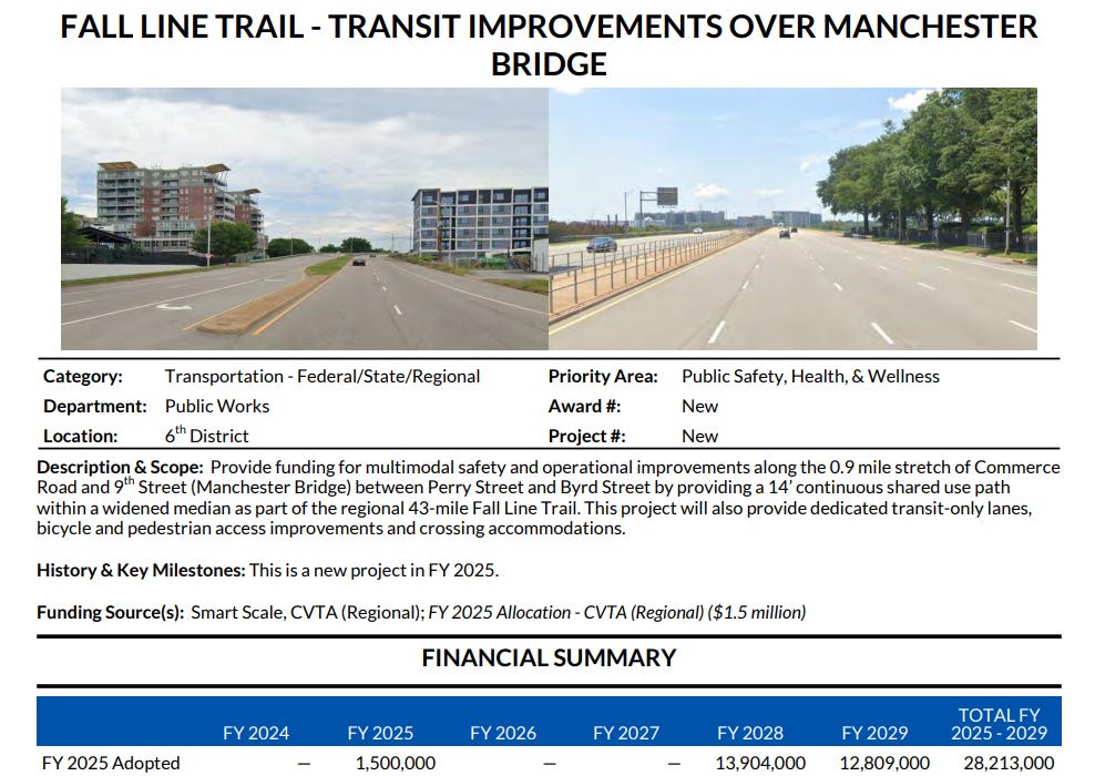
In the case of the 53 year old Manchester Bridge, most of the issues with traveling across it by bike or on foot will be assuaged by the Fall Line Trail, a shared-use path that will one day connect Ashland to Petersburg by way of Richmond City. Per the most recent information, the Fall Line Trail will travel across the elevated median walkway for the duration of the Manchester Bridge, which will also be widened and possibly elevated.
The details provided by the Office of Equitable Transit and Mobility are a bit unclear about how the Fall Line Trail will connect in with Commerce Road South of the River (and the engineer in charge of the project did not respond to my inquiry), but it seems likely that users of the Fall Line Trail will not need to use the staircase down to Semmes Avenue that is currently at the terminus of the median walkway. Instead they will likely have a direct link into the next section of the Trail on Commerce Road.
The GRTC’s future North South Bus Rapid Transit line will also cross the Manchester Bridge. The recently released renderings for the project indicate that the right travel lane will be replaced with dedicated bus lanes, and appear to show that the bike lanes will still be in their current position.

These bus lanes will serve to better buffer bicyclists traveling in the bike lane from car traffic.
(I still haven’t given up on my dream for a Brown’s Island Bus Rapid Transit Station, by the way)
The Fall Line Trail and the Bus Rapid Transit line will greatly enhance the safety and comfort of anyone crossing the Manchester bridge outside of a car. The only problem for frequent users such as Mendez and Paschall is the timeline of these solutions.
Per the City of Richmond’s FY2025 Budget and Capital Improvement Plan, full funding for the BRT and Fall Line Trail improvements will not be allocated until 2029 (and don’t even get us started on the timeline for the full Fall Line Trail project).
Though it's nice to see that there is already money set aside for this section of the Fall Line Trail, there is still room for Lighter, Quicker, Cheaper solutions that could bring faster fixes to this section of the City.
Faster, Less Permanent Solutions
Borrowing ideas from other projects in Richmond and abroad to provide short-term relief
When asked what would make his daily commute feel safer across the Manchester Bridge, Mendez said that he’d like to see “any form of protection, even those cone things you see in other bike lanes.” He was, of course, referring to the flexible delineators that are common in several Richmond City protected bike lanes.

The delineator barriers could be further supplemented by temporary planter boxes, as suggested by the Minneapolis Street Design Guide, which would both provide more solid protection and help supplement the vision of a “bridge park” aesthetic over the James River.

Perhaps bike commuters like Paschall would feel more drawn to the Manchester Bridge if it were to emulate the natural beauty provided by the T.Pot bridge, thereby reducing space conflicts between commuters and sightseeing pedestrians along the lower bridge.
Another simple intervention could be to install bike friendly stormwater drainage grates, such as those required in Washington, DC, so that bicyclists like Mendez don’t need to swerve towards car traffic to avoid them.
Other, more ambitious solutions could include prematurely marking the planned bus lanes on the Manchester Bridge, as implemented by Greater Chicago’s PaceBus Tactical Transit Pilot Program.

Though the new Bus Rapid Transit line won’t be in service until 2031, GRTC’s route 2 bus currently crosses the bridge on 15 minute intervals. The temporary bus lanes could both serve the existing bus line as well as provide a greater buffer area for bicyclists along the bridge.
As for the issues with speeding cars along 9th Street, more aggressive enforcement could go a long way. The National Association of City Transportation Officials, however, provides evidence that paint could do the same job as police in this situation. When car travel lanes are narrowed by even 1 foot, drivers tend to reduce their speed because the environment tells them that they are in a City, and not on a highway.
Though there are several inspiring long term solutions in the pipeline for the Manchester Bridge, low-cost temporary solutions would provide relief to current users of the bridge, and may even induce demand from the “interested but concerned” category of Richmonders.
For the members of our community who have no intention of walking, biking, or taking transit even after the coming improvements: every person who takes an alternative means of transportation is one less car on the road during rush hour.
Thanks for reading!
If you’d like to share an idea or your voice for another story in this series, please send an email or
As always, don’t forget to:
I think this is a great thing to report on. I agree that people drive way too fast on the Manchester and Lee bridges and I don't think they do it intentionally, it really feels like a highway. I know it's a steady stream of income for the city but I would prefer if they added slowing mechanisms like typical road diet stuff that would reduce number of lanes and increase bike lanes. And, even though I would hate it and so would everyone else, some traffic humps on the bridges would slow people down and maybe get rid of the speeding dirt bikers going 80.
The south side of the Manchester bridge ends with one right lane going to Jahnke. How will the bus/bike set up accommodate drivers going that way?