Changes Coming to Richmond's Riverfront: Part Two
This second installment will look at the ways we can currently access Brown's Island, and how transportation to this area is expected to improve over the next several years.
If you want to read the first part of this series focusing on new developments and services coming to Brown’s Island, click here!
The Problem With Parking at Brown’s Island
An overview of the issues with parking at the most popular river sites, and a case for why it’s inevitable.
Currently, many visitors drive to the river. Those of us who have done this are well familiar with making multiple loops through the Belle Isle parking lot before trying our luck along 5th street. It’s worth noting that the parking issue on this side of the river isn’t exactly a new problem. A quick internet search reveals articles dating back from 2019 or even 2010 discussing the difficulty in finding parking at this iconic riverfront location.
As we discussed in the first installment of this series, there are several major improvements coming to this small region that will make it even more popular and trafficked. Despite this, there are no plans to add additional parking to this area.
The problem with adding parking is relatively obvious: it’s very expensive, and it obscures the natural beauty of the area (you know — the reason why people want to be there in the first place).
According to a 2022 estimate by the design Firm WGI, building a parking deck in Richmond costs upwards of $25,000 per space. This means that accommodating a parking space for each potential visitor to, say, the 7,500 person Riverfront Amphitheater, would be more than six times the cost of the actual project.
More importantly, per the warning from folk artist Joni Mitchell, a major reason that people flock to Brown’s Island, Belle Isle, and the surrounding trails is that they provide access to nature. The irony of wanting to provide superior parking services to a natural destination is that the parking superstructure would obstruct and recharacterize the view of an area that is famous for how it currently looks. If you pave paradise, there’s better parking but no reason to park there anymore.
The city won’t be adding more parking spaces in and aorund Brown’s Island, but alternatives to driving will only improve in coming years.
Overcoming Parking Challenges at Richmond’s Riverfront
Here are a few ways to access Brown’s Island and Belle Isle when parking is scarce.
Though the Belle Isle parking lot is hit or miss in terms of finding a space, many people use a few parking “secrets” in order to enjoy the area. Save for a major event happening on the island, there is often available street parking on Second Street, which is a short walk up the hill from the existing parking lot. Other river users enjoy parking near the overlook in Oregon Hill, and consider the walk down via the North Bank Trail to be a component of their visit.

I often see people unloading a bike from the rear rack of their car in the Belle Isle parking lot and think about how inconsequential the extra 0.2 miles would be on a bike if they had instead parked on Second Street or in Oregon Hill.
Traveling with a bike easily opens up parking options within a mile radius or so from the Belle Isle/Brown’s Island area due to the relative ease of covering that distance on a bike. This means that thousands of parking options are in play for this mode of transportation. As Ned Oliver reported for Axios in 2023, 20% of the space in downtown Richmond is already devoted to parking.
With a bike, of course, you could also travel the entire distance to the location from your home and ditch the car entirely. The third section of this article will be looking at ways that the City will be making that easier to do in the future.
It’s also worth noting that the GRTC bus service in Richmond is still FREE for another year (with plans in motion to extend it for much longer). With no need to buy a fare or install a phone app to ride, getting on the city bus is as easy as waiting at a bus stop. The GRTC provides anyone in Richmond a free account on the Transit App, which provides real-time bus tracking and route information. Consumers who aren’t interested in downloading a new app could even simply switch to the public transit icon on google maps.
For individuals who don’t want to, or feel like they can’t take the GRTC bus from their home to the Richmond’s Riverfront, there’s also the option to treat the GRTC like a parking shuttle. Park where it’s cheap (or where you plan to get dinner later) and then ride the free GRTC bus to/from the riverfront.
There are three routes on the GRTC to use to access the riverfront: Route 2, Route 3, and Route 87. The first two of these routes originate in the Northside, then service downtown and continue to destinations in the Southside of the City. This means that people who live in these highly populated parts of the City have direct bus access to the Riverfront, and dining or parking options along these routes could easily use the GRTC as a shuttle to/from the river. Remember- you can see the closest GRTC bus stops to the Riverfront in this custom google map I created, that also includes all of the improvements referenced in the previous article in this series.
GRTC Route 2
Like Routes 1 and 3, Route 2 contains a trunk section with 15 minute frequency in the Northside and Downtown, and then splits into three different routes (A, B, and C) that serve different portions of the South Side at lower frequency.
Riders on Route 2 should get off the bus at the “8th + Byrd” stop at Kanawha plaza then walk down the hill to Brown’s Island via Byrd Street then S 7th Street.
GRTC Route 3
Route 3 also travels on a 15 minute frequency, and passes down Belividere through VCU campus before splitting off into it’s South Side segments (A and B). Access to Belle Isle coming from the north should be the last stop before the bridge, called “Belvidere + Holly.”
From the stop it’s an easy walk down the hill past the the Oregon Hill Overlook or via 2nd street, following the same route as people who park in this area.

GRTC Route 87
The stop for Route 87 is the closest of the three routes to the Riverfront, with the “Second and Brown’s Island Way” stop being a mere feet away from the Riverfront Amphitheater. The catch with this stop is that GRTC Route 87 only runs once an hour on weekdays and no weekend service.
The silver lining is that the GRTC Transit Strategic Plan, a publicly reviewed plan intended to guide the growth of Richmond’s transit system over the next decade, outlines an increase on this route to a 30 minute frequency Monday-Saturday, and hourly service on Sundays.

For those who want to catch this convenient access point to the river before the service is upgraded, it may take using the transit app and some very deliberate planning. The route itself meanders along the South Side past Southside Plaza, crosses the Lee Bridge, passes the Riverfront on Second Street, then heads downtown to it’s terminal point at the Transfer Station.
In my experience, it’s easiest when you remain flexible as to your arrival and departure route, and use the transit app in order to ensure you’ll catch an easy connection. In my most recent trip to Belle Isle with my daughter, we took the Route 3 into Oregon Hill then walked down the hill via the North Bank Trail. On the way back home we caught the elusive 87 to Broad Street and then linked into the Pulse for the final leg of the trip.
Visiting Richmond’s Riverfront in the Future
An overview of Richmond City capital investments that will make the river easier to access
According to studies by Dr. Jennifer Dhil of Portland State Universtiy, 63% of citizens living in the top 50 metro areas in the USA (Richmond is ranked #43) would be interested in biking for their daily needs if there were safe infrastructure to make it possible. In order to better provide this infrastructure, Richmond is in the process of designing or soliciting funding for several projects that link Brown’s Island into car-free trail bike/ walk trail systems such as the Capital Trail or the Fall Line Trail. There are also several investments going into making the area by Brown’s Island ADA accessible with appropriate sidewalks and ramps. These improvements, combined with investment in transit systems such as the N-S BRT line, will lead to a Riverfront campus in Richmond that is easy and safe to access without the use of a car.
In this final section I’ll outline a few of these changes, share their timeline for completion, and talk about why they’ll improve access to Richmond’s Riverfront. I’ll also share a fantasy plan of mine that I’d love to see become a reality on the N-S BRT line plan.
Connecting to the Capital Trail
The Capital Trail, after spanning 52 miles from Williamsburg to Richmond, meets an abrupt ending at the floodwall in Shockoe Bottom near the intersection of Dock Street and 14th Street.
Starting in Spring of 2025, there will be a better connection from the Capital Trail all the way to Brown’s Island by way of the canal walk. The project, called “Virginia Capital Trail Connection to Brown’s Island,” aims to provide “An improved connection from the Virginia Capital Trail (VCT) to the Potterfield Memorial Bridge located on Brown’s Island, via the Canal Walk in downtown Richmond.” according to Richmond’s Capital Project Dashboard. This will include replacing stairs with ADA compliant ramps where necessary, which will also aid in making it more easily bikable.
I wanted to add more details about the way the connection would be improved using the 30% engineering design plans for the project, but the department of public works is a bit late responding to my most recent FOIA request. This is par for the course in the city, unfortunately. Hopefully we will have more details about this new connection in the next article!
Pedestrian Improvements Along Tredegar Street
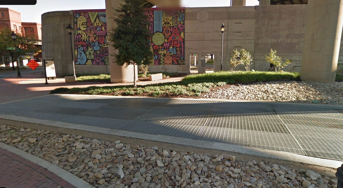
Tredegar Street, the road closest to the James River that connects Belle Isle to Brown’s Island, leaves a lot to be desired when it comes to pedestrian convenience.
Note above how there is no way on either side of the road that a wheel chair or stroller could pass.
In response to this issue, the city will be completing an update on this section of Tredegar Street. By the summer of 2025, there will be ADA compliant sidewalks on both sides of Tredegar Street. This will make it easier for everyone to access Brown’s Island and to travel between the different river sites.
Fall Line Trail Access and Other Future Trails
The Richmond Connects Near Term Action Plan, a comprehensive document that prioritizes transportation improvements in the City over the next decade, identifies “Shifting the Car Narrative” as one of the essential strategies in building Richmond’s future transportation network. Essentially, the action plan acknowledges how previous iterations of transportation planning have been fully centered on the use of single occupant motor vehicles. In order to incentivize and allow for more efficient transportation modes throughout the city, Richmond Connects contains many plans for different shared-use trails that would allow pedestrians and bikers a safe and car free path through the city.
Both the PlanRVA’s Bicycle and Pedestrian Infrastructure Map as well as the Richmond 300 Future Connections Map outline several trail connections that will serve the Brown’s Island riverfront area. The most iconic trail is the Fall Line Trail, which will connect from Petersburg to Ashland by way of downtown Richmond, with an estimated completion time between 2029 and 2031. The Fall Line Trail will not directly pass through the Brown’s Island area, electing instead to travel above it by way of the Manchester Bridge.
Though the main traffic of this trail will bypass the Riverfront, there will be spurs that allow trail users to branch off into the T. Tyler Potterfield Memorial Bridge (“T.Pot”) that connects directly into Brown’s Island.
There are also several trails that don’t have a specific construction date that appear in the Richmond 300 future connections map, such as the Reedy Creek Greenway, which will travel largely along the fire road near Riverfront Drive and link up with both the Fall Line Trail as well as the T. Pot bridge. This Greenway would also provide a connection in the opposite direction through Forest Hill Park.
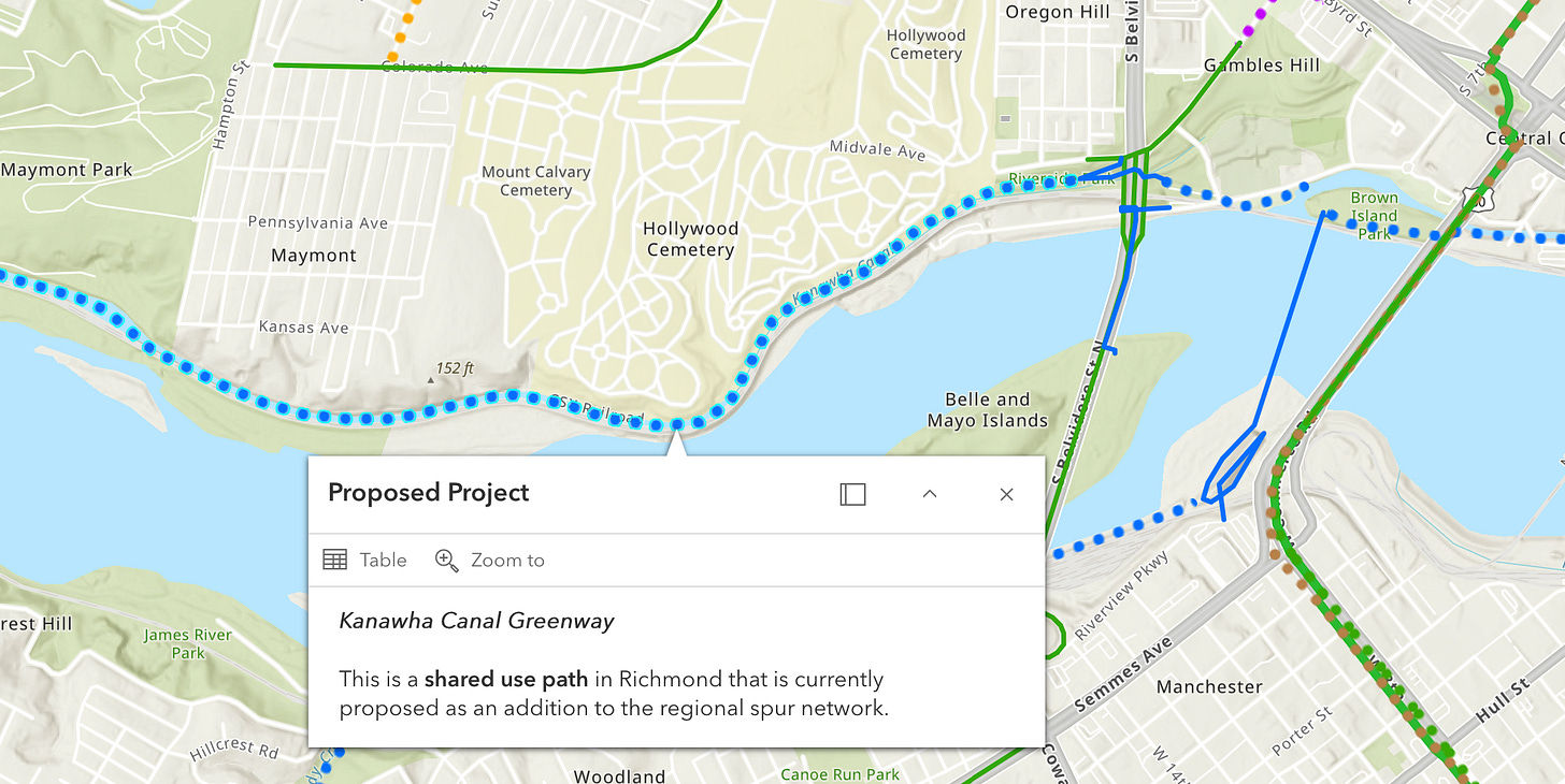
On the North of the River, PlanRVA’s Bicycle and Pedestrian Infrastructure Map shares a future (but with no construction date) plan to possibly convert portions of the existing North Bank trail into a paved shared-use path that would connect the Brown’s Island riverfront to neighborhoods such as Randolph and Maymount.
It’s easy to go down the rabbit hole about future projects that don’t yet have funding or a timeline such as the previous two mentioned. It’s worth noting that as of this moment the only funded plans to connect Brown’s Island to the Capital Trail, and to connect the Fall Line Trail to the T. Tyler Pottersfield Bridge by way of a short shared use path referred to in the FY2025 Budget and CIP Plan as the “Manchester Connection” on page 406.
These two major connections will make arriving to the riverfront by bike or on foot considerably easier. It will also make Brown’s Island and Belle Isle feel more connected to the surrounding city without having to use a car as an intermediary.
The Dream: A Rapid Transit Stop at Brown’s Island
This last piece is less based on any real news (or shreds of news) and more a complete dream of mine. Essentially, I believe the way to truly make the need for parking at Brown’s Island and Belle Isle irrelevant is to integrate Brown’s Island into the future North-South Bus Rapid Transit System.
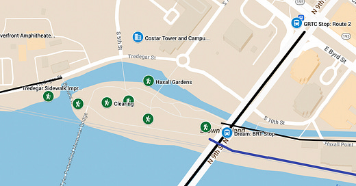
Like the Fall Line Trail, the BRT system will pass over Brown’s Island on the Manchester Bridge. I think it is likely that there will be a stop around Kanawha Plaza due to the existing plans to improve this area that are already in the CIP budget (in fact, I have an entire prediction map for the N-S BRT system that I’ll share in a future article). Though it is only 8 minute walk from the plaza to Brown’s Island, the hill and the distance would be an issue for some transit users. Instead, I’d like to see a BRT stop called “Brown’s Island” that sits directly above the Island on the Manchester Bridge.
Though it may seem excessive to propose building a stair system and elevator to connect a BRT station on the bridge to Brown’s Island below, I’d like to remind that nearly every major transit system does something like this each station. Miami and Chicago’s metro train systems are elevated and every single station requires platforms, stairs, and elevators to connect to the streets below. The subway metro systems found in New York and Washington D.C. require elevators and stairs being dug out of the ground to connect to underground tunnels.
When you think of the infrastructure cost required for every stop in these major transit systems, it starts to seem less ridiculous to have a single elevated Bus Rapid Transit stop that would serve the entire Richmond riverfront including Brown’s Island, Belle Isle, the new Riverfront Ampitheater, and the new CoStar Campus.
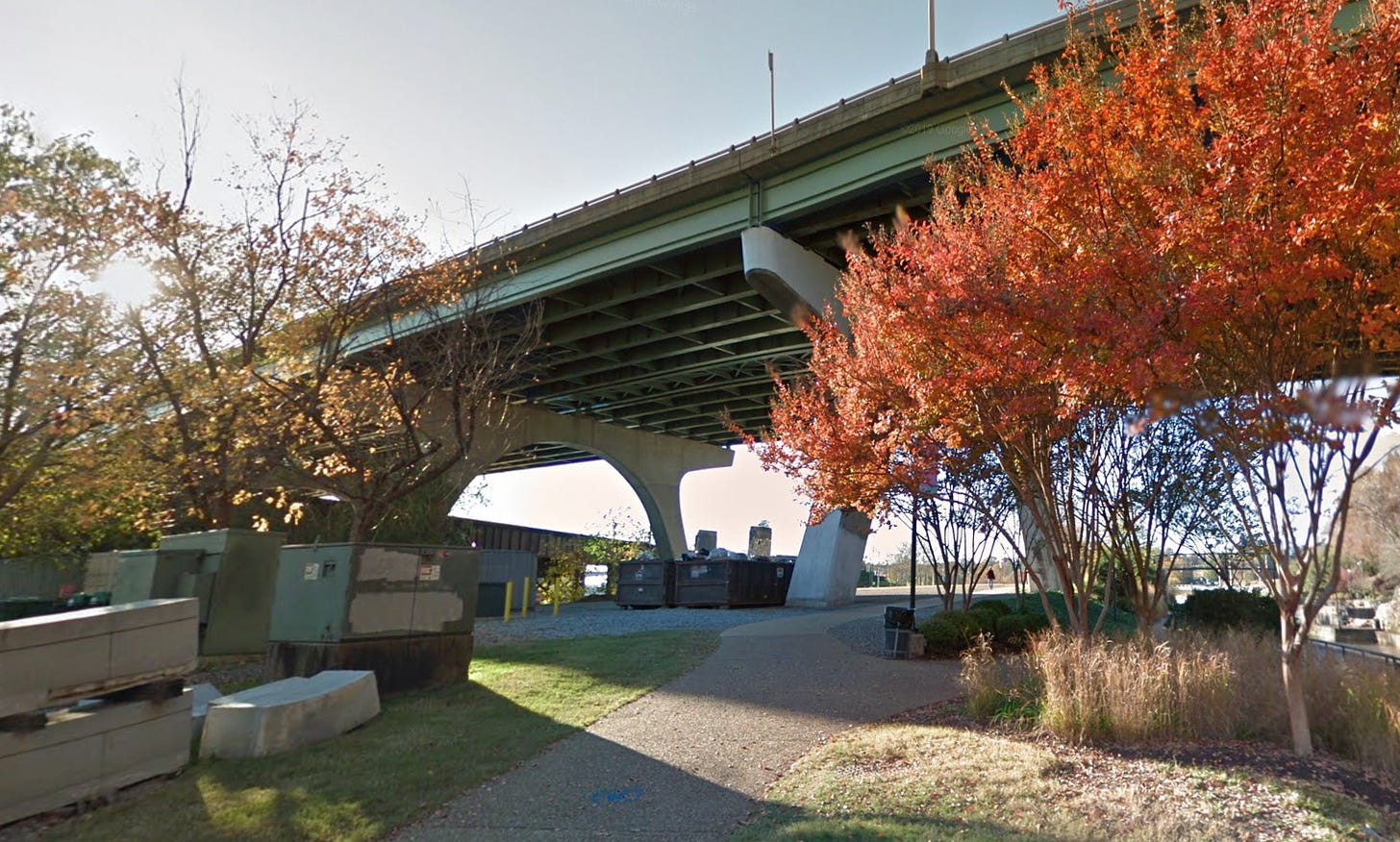
The Brown’s Island BRT stop would arrive in the area soon to be called the “Back Porch,” which is already planned to serve as an entrance area to those connecting to Brown’s Island from the Pipeline Trail or the Canal Walk, and so an elevator and staircase leading to the BRT stop could easily be integrated into the existing vision.
It’s also worth noting that the Fall Line Trail will cross along this same bridge, so trail users would also be able to take advantage of this direct access to what will soon be one of the most iconic parts of the city.
The N-S BRT study is currently on the phase where they will determine specifics of the route (such as the parts through downtown Richmond) as well as the station locations along the route, which means that we have from now until 2026 to advocate for a Brown’s Island Station on the new BRT system.
Thanks for reading!
As always, don’t forget to:


Great ARTICLE, thanks for the info!